Aleutians
(52.0765, -176.1109)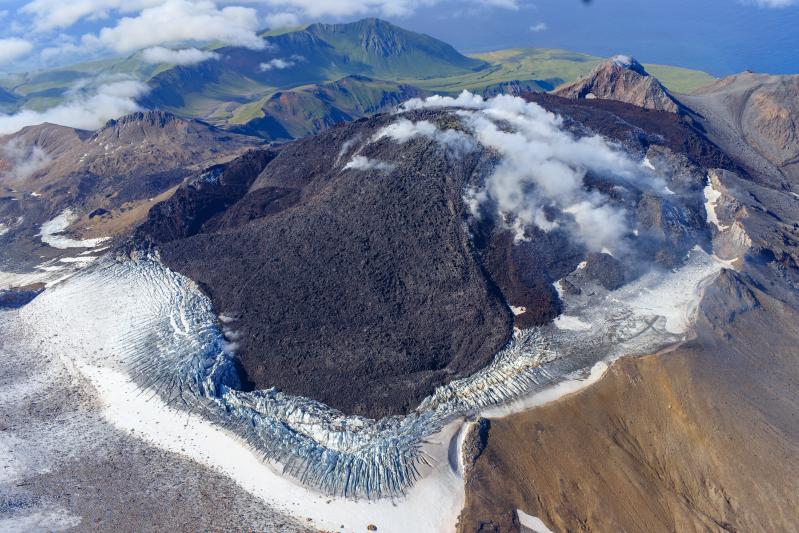
Great Sitkin Volcano is still erupting lava slowly within its summit crater. Seismic activity remains minor, and satellite data shows slightly elevated surface temperatures, consistent with active lava effusion. Nothing noteworthy was observed in clear web camera views.
The current lava eruption began in July 2021 and since then has filled most of the summit crater and advanced into valleys below. There have been no explosions at Great Sitkin Volcano since an event in May 2021. The volcano is monitored using local seismic and infrasound sensors, satellite data and web cameras, and regional infrasound and lightning networks.
Aleutians
(54.7554, -163.9711)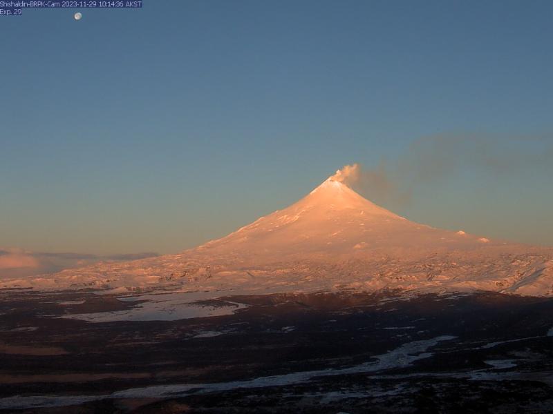
Shishaldin Volcano continues to experience unrest. Webcam images captured yesterday and this morning revealed a minor steam plume at the summit. Over the past 24 hours, occasional small earthquakes have been detected. Infrasound signals, normally present, have been obscured by high winds. Strong winds in the region have produced clouds of resuspended ash and dust, visible in satellite imagery south of Shishaldin (https://www.weather.gov/aawu). No signs of volcanic activity were observed in satellite imagery.
Local seismic and infrasound sensors, web cameras, and a geodetic network are used to monitor Shishaldin Volcano. In addition to the local monitoring network, AVO uses nearby geophysical networks, regional infrasound and lighting data, and satellite images to detect eruptions.